
Historic 1880s Toledo Plat Maps Preserved and Now Accessible to the Public
TOLEDO, Ohio — In a significant step toward preserving its rich history, the City of Toledo has completed a project to restore and digitize a collection of 1880s plat maps, offering residents and historians alike a rare glimpse into the city’s past. The maps, which were discovered in the attic of the Toledo Police Department Safety Building, have been scanned and made available for public viewing online.
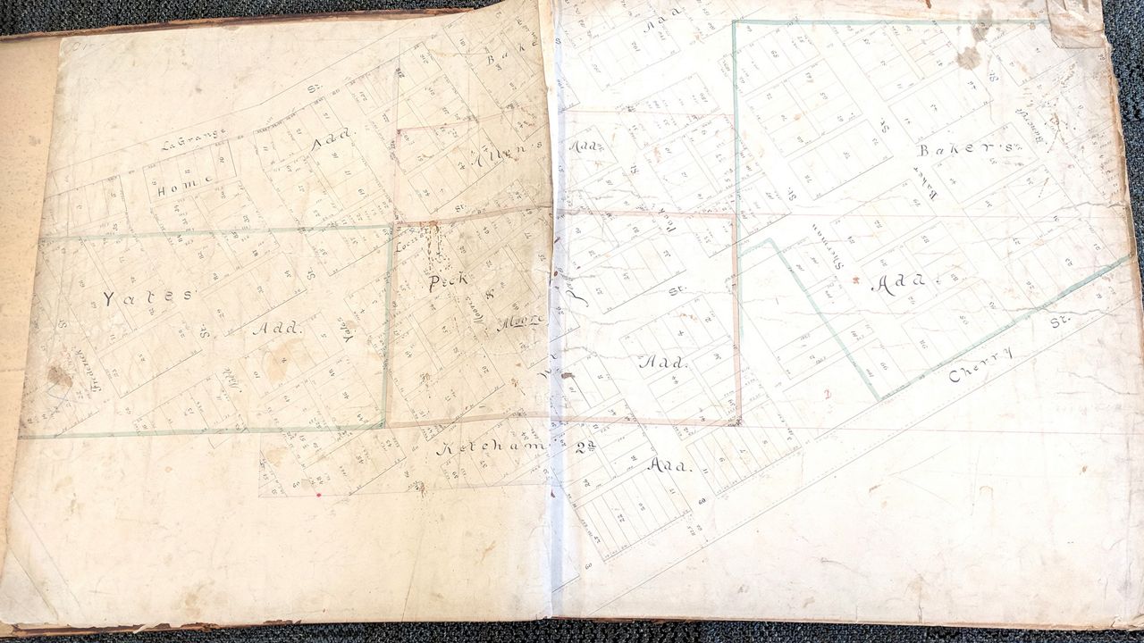
The project, funded by a $2,480 grant from the Ohio Historical Records Advisory Board in 2025, aims to safeguard these hand-drawn linen plats, which depict Toledo’s early neighborhoods and land parcels. So far, over two dozen maps have been processed, with plans to preserve approximately 660 pages in total.
Plat maps, often created by land surveyors, provide detailed layouts of individual lots and neighborhoods. These particular maps, dating back to the 19th century, offer invaluable insights into Toledo’s architectural and industrial evolution. Laura Shaffer, grants coordinator for the city, emphasized their historical significance.
“These representative samples give us glimpses of the past and a chance to explore what the city looked like almost 150 years ago,” Shaffer said.
The maps reveal Toledo’s early struggles with swampy terrain and limited transportation, which initially hindered its growth. However, the mid-1800s saw transformative developments, including the draining of the Great Black Swamp and the introduction of the railroad system. These changes spurred Toledo’s first major population boom, with a 62% increase in residents during that decade.
Among the neighborhoods documented in the maps are Birmingham, Englewood, Junction, the Old West End, and East Toledo. One particularly intriguing area is Cycledale, a ghost neighborhood that once housed Toledo’s transportation manufacturing industry. Today, the site is home to the Overland Industrial Park.
“These plats show us the birth of Birmingham and the growth of neighborhoods like Englewood,” Shaffer explained. “We can trace the history of Toledo’s transportation manufacturing industry in Cycledale. These maps help us find past connections and reimagine landscapes lost to time and redevelopment.”
Julie Gibbons, Clerk of Council, played a pivotal role in identifying the maps’ historical value after their discovery. The preservation effort underscores Toledo’s commitment to honoring its heritage and making it accessible to future generations.
Residents and history enthusiasts are encouraged to explore the maps online, where they can delve into Toledo’s early architecture, infrastructure, and community development. Shaffer invites the public to “peer into the past and imagine what the people who drew them were envisioning for our future.”
The digitized maps are now available for viewing on the City of Toledo’s official website, offering a unique opportunity to connect with the city’s roots.
— Reported by Nexio News
