
Severe Thunderstorms Threaten Ohio with Damaging Winds, Flooding Risk
Ohio braces for a round of powerful thunderstorms expected to roll in late Monday night, bringing the potential for damaging winds, heavy rain, and localized flooding. The greatest risk is concentrated in western Ohio, where storms could intensify after 10 p.m. before pushing eastward overnight.
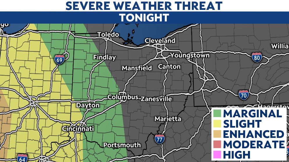
Timing and Threats
While Monday will stay mostly dry, isolated showers and thunderstorms are likely to develop in western Ohio by evening. The main line of storms is forecast to sweep across the state between 10 p.m. and 3 a.m., exiting eastern Ohio by early Tuesday.
The Storm Prediction Center has issued a Level 1 (Marginal Risk) severe weather alert for western Ohio. The biggest concern? Wind gusts up to 60 mph, which could down tree limbs and power lines. Heavy rainfall may also lead to ponding on roads and minor flooding in low-lying areas.
Extended Unsettled Weather
The stormy pattern isn’t a one-night event. Forecasters warn of additional showers and thunderstorms on Tuesday and Wednesday, keeping flood risks in play. Residents, especially those in flood-prone zones, should stay alert.
Safety Reminders
With storms hitting overnight, officials urge Ohioans to:
- Secure loose outdoor items before nightfall.
- Avoid unnecessary travel during heavy rain and wind.
- Keep phones charged for weather alerts.
As the system moves through, emergency crews will be on standby for possible power outages and road hazards. Stay tuned to local forecasts for real-time updates.
— Reported by Nexio News
