
Ohio Braces for Summer-Like Heat and Scattered Storms This Weekend
Ohio residents can expect a warm end to the workweek, with temperatures soaring into the lower to mid-80s on Friday. However, the summer-like heat will also set the stage for scattered showers and thunderstorms, particularly in the late evening, as a weather system moves across the region.
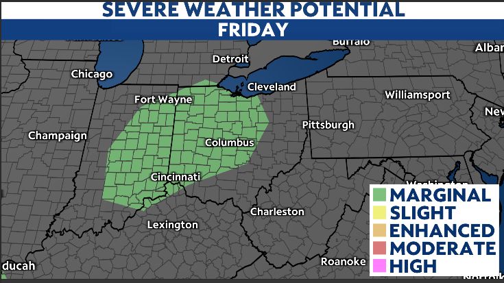
Meteorologists note that while daytime showers will be widely scattered, the chances of rain and storms increase significantly by Friday evening. Although the threat of severe weather remains low, some stronger storms could produce heavy downpours, small hail, and wind gusts of up to 40 mph. Residents are advised to stay alert and have a plan to move indoors if conditions worsen.
The weather could also impact outdoor activities, including Friday evening’s Cincinnati Reds game against the Detroit Tigers at Great American Ball Park. With the first pitch scheduled for 6:40 p.m., fans should prepare for possible delays due to the storms.
The gusty weather is expected to linger through the late evening but will clear out overnight, moving west to east. This means Saturday’s daytime hours will likely remain dry, offering a brief respite before another weather system arrives.
Sunday is forecast to be quiet, but attention will turn to a more powerful storm system expected to move in late Monday. This system has the potential to bring more severe weather, including heavy rainfall, strong winds, and possibly hail. Meteorologists are closely monitoring its development and will provide updates as the weekend progresses.
Residents are encouraged to stay informed about the latest weather conditions and take necessary precautions, especially if planning outdoor activities or travel.
— Reported by Nexio News
